July 16 Slight Risk For Storms To Turn Severe Today – Just In Weather
July 16 2022
Saturday Morning Update
We have a disturbance that will trigger showers and storms today. I have some computer models guidance here as a suggestion for timing and location, but I need to emphasize that they are NOT perfect.
I say that because I see some showers already this morning, and there is a discrepancy between the HRRR and NAM Models for early afternoon around metro areas. There is more agreement for a larger impulse this evening and tonight to impact southern Maryland.
This is the NOAA Outlook, which has our region as ‘Slight Risk’. This is the lowest level of awareness, 1 out of 5. For comparison, the Tuesday outlook was level 3.
Out of all the storms, perhaps 15% could turn severe with damaging winds or large hail).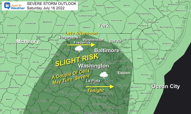
That line of clouds is our impulse. Timing this with the heat of the day is the program for today. 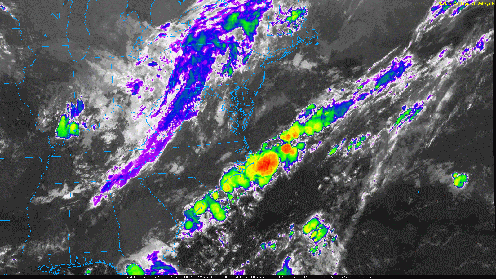
We have a hint of mugginess back this to start the day.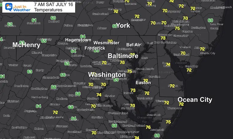
These are guidance not gospel. Both products have their strengths, but I have noticed some activity en up more robust and the timing off by an hour or so… possibly sooner, than shown here.
This shows late morning and mid day showers, then a focus in the afternoon across southern Maryland.
The stronger impulse arrives by evening… reaching Baltimore by 8 or 9 PM, with southern Maryland getting it tonight.
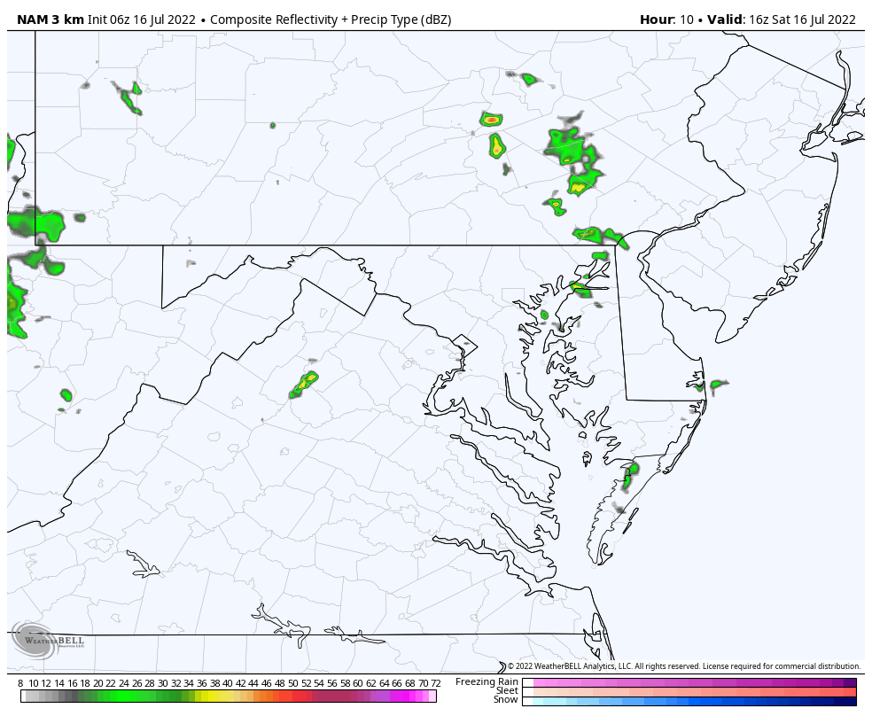
The difference here is missing the late morning and mid day activity
AND
More storms from Hagerstown to Westminster and York between 1 PM and 5 PM.
The agreement is the line of showers/storms near Washington by 7 PM pushing into southern Maryland after sunset.
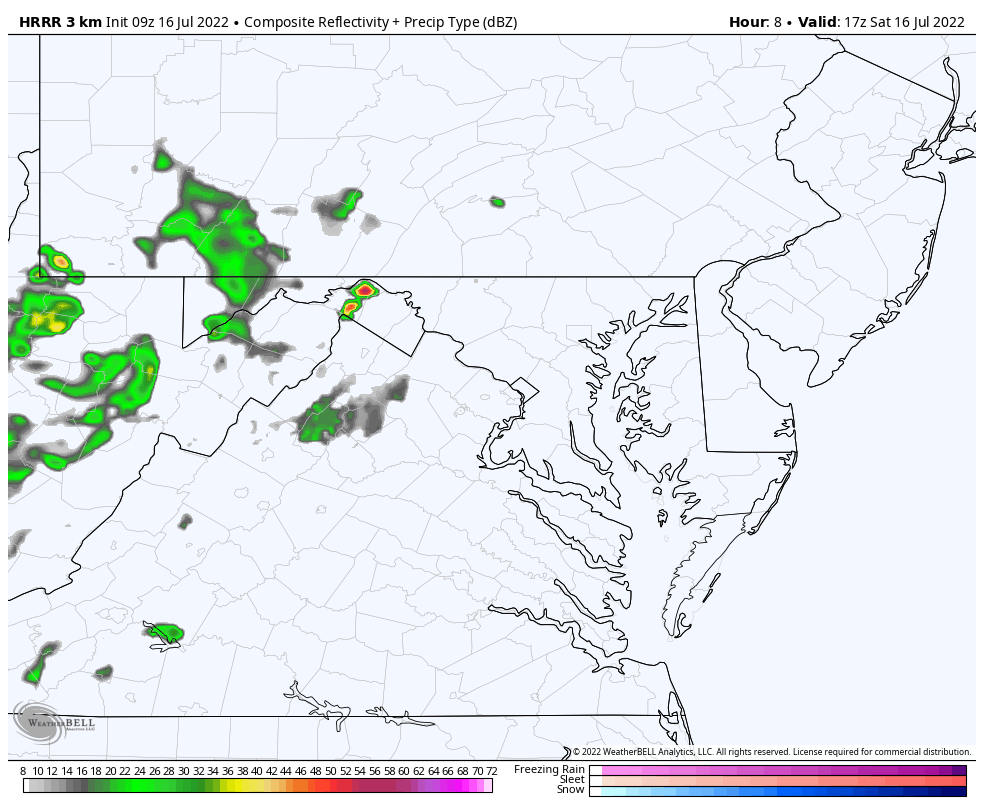
This model is is missing any activity this morning, but picks it up for the afternoon and evening. You can see it does agree with the NAM 3 Km on the line of stronger activity near and south of Washington to Southern Maryland.
I believe we will track morning showers that the models were missing…
July 12 Severe Storm Radar Scans: Was There A Tornado Or Not?
July 12 Storm Reports Pics And Videos
Normal Low in Baltimore: 67ºF
Record 57ºF in 1954
Normal High in Baltimore: 88ºF
Record 104ºF 1988
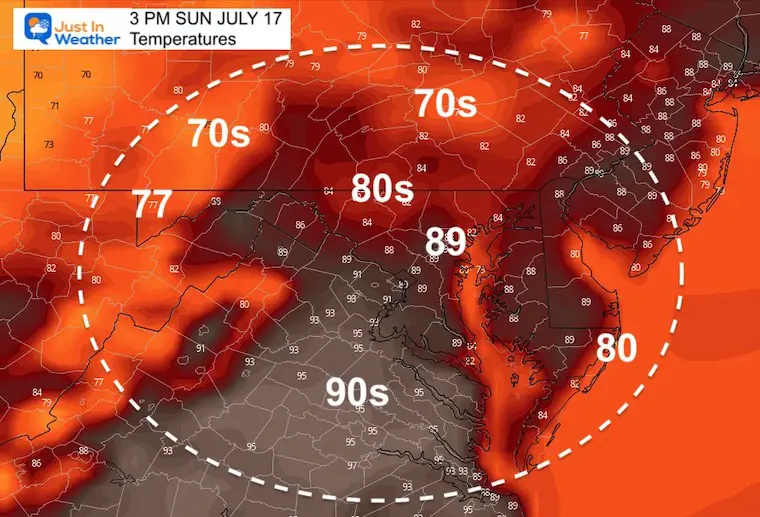
More storms likely Sunday Evening could turn severe!
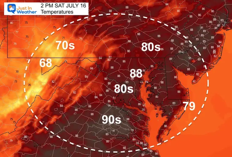
Then we watch for high heat and a true heat wave (rare this summer) during the week. 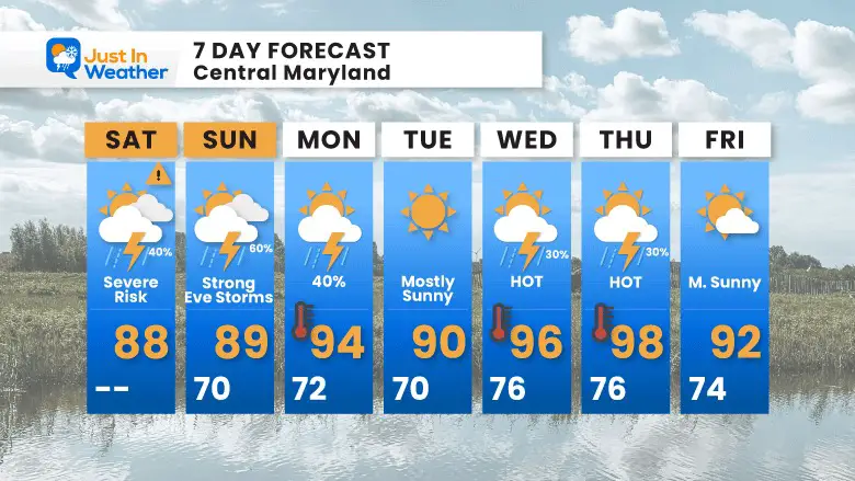

NOAA 2022 Hurricane Forecast- Above Normal Again
Atlantic Hurricane Forecast
NOAA Study: Reducing Air Pollution INCREASED Tropical Storms
Atlantic Tropical History: Maps of Origin Regions Every 10 Days
Atmospheric Memory Of Hurricanes Over Thousands Of Years Shaped The Coast
May 22 Hail And Wind Damage
May 16 Large Hail Videos And Storm Tracking Map

*Disclaimer due to frequent questions:
I am aware there are some spelling and grammar typos. I have made a few public statements over the years, but if you are new here you may have missed it:
I have dyslexia, and found out at my second year at Cornell. I didn’t stop me from getting my meteorology degree, and being first to get the AMS CBM in the Baltimore/Washington region.
I do miss my mistakes in my own proofreading. The autocorrect spell check on my computer sometimes does an injustice to make it worse.
All of the maps and information are accurate. The ‘wordy’ stuff can get sticky.
There is no editor that can check my work when I need it and have it ready to send out in a newsworthy timeline.
I accept this and perhaps proves what you read is really from me…
It’s part of my charm.